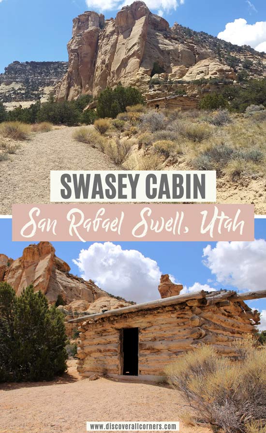
The Swasey Cabin is a historic landmark located in the central part of the San Rafael Swell known as the Sinbad Country, just west of Green River, Utah. Unlike many other points of interest in the San Rafael Swell, the cabin is easy to access for most vehicles as long as the roads are dry, although a high clearance 4WD is recommended as you’ll be driving on primitive roads.
The cabin was built in 1921 by Joseph Swasey, one of the earliest explorers and settlers of the San Rafael Swell together with his brothers Rod, Sid, and Charley. The Swasey brothers were ranchers and used the cabin as a stopover for their livestock operations, though they were running cattle and horses in the area long before this cabin was built, going as far back as the late 1800s.
The Swaseys were well known in the area back then, and their significance in the San Rafael Swell is obvious from many of the local landmarks bearing their name – among them Rod’s Valley, Sid’s Mountain, Sid’s Leap, the rock formation Joe and His Dog, and the Sid and Charley hoodoos.
Word of mouth says that the brothers did a lot of teasing and exploits to one another, and that’s how Sid’s Leap supposedly got its name, too. Told by Royal Swasey, the son of Joseph Swasey, in the late 1880s Charlie wagered a small herd of cattle after Sid bet him that he could jump his horse over the narrow San Rafael River Canyon. It’s about 8 feet at the narrowest wall-to-wall point there, although to make a safe jump you’re close to 11-12 feet in distance – all while the gorge drops 55 feet down to the bottom. Low and behold, Sid did make the leap and won the cattle! Although Charley didn’t bet on his return jump across and Sid admittedly took the long walk back around the gorge instead of leaping back.
Though the desert can be harsh and unforgiving, Joseph Swasey could meander out into the badlands of the San Rafael Swell for long periods of time with only as much as a knife and survive just fine. When he needed water, he knew how to find it. Same for food, even if his only option was a rattlesnake. This was a guy that feared nothing, at least that’s how people had perceived him and spoken of him. Besides ranching, Joe was also a prospector, having located some valuable mineral mining claims, including at the nearby Temple Mountain.
Joseph Swasey was 60 years old when he had built the cabin, using Douglas Fir logs hauled up from the nearby Eagle Canyon.

Back in the day the Swasey Cabin was furnished with two bunks, chairs, table, and a wood range, but nothing remains today.
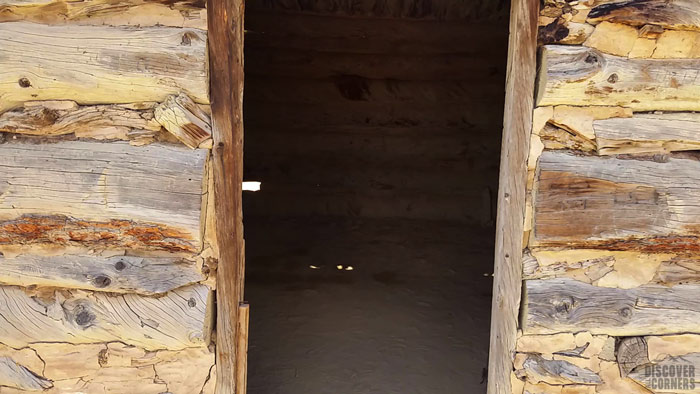
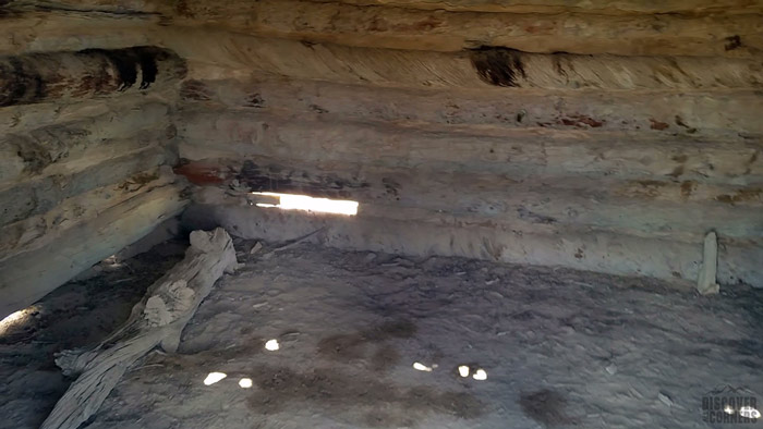
There is a large parking area here with a pit toilet, and a kiosk with bits of information about the cabin. A short packed-gravel path leads to the cabin from the parking lot, making the site accessible even for strollers.
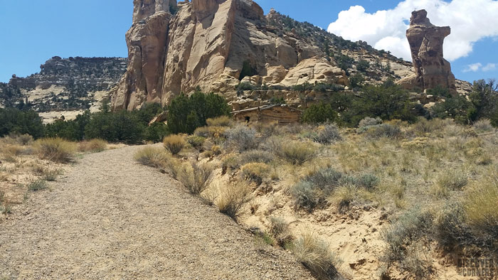
Today the San Rafael Swell remains nearly as wild as it was back in 1921 when the Swasey Cabin was built, although the area surrounding the cabin was far more remote than it is today. Up until 1970 when the segment of I-70 that cuts through the Swell was completed, this was an incredibly desolate place that seldom saw visitors.
On your visit of the Swasey Cabin, consider stopping by the Icebox – a cave-like rock formation near the Swasey Cabin that the Swaseys used to store their perishables. A short unmarked trail that leads to the Icebox starts right near the cabin.

If you watch the video below, please note that the Icebox I’m referring to in that video is further down the path. The rock formation shown is probably what’s called Joe’s Office.
Points of interest near the Swasey Cabin:
- Icebox Foot Trail
- Lone Warrior Pictograph
- Head of Sinbad (Locomotive Point) Pictographs
- Lucky Strike Mine
Directions to the Swasey Cabin
GPS coordinates: 38.83580, -110.80716
There are two main ways of getting here:
- The easier route (11.5 miles) – access from I-70; suitable for most vehicles as long as the road surface is dry (but still a 4WD is your best bet);
- The scenic route (19 miles) – primitive roads through the Swell; a high clearance 4WD is recommended.
Both versions require driving on unpaved roads, but if you take the scenic route, your time spent on primitive roads will be much longer.
Several routes lead to the Swasey Cabin through the conglomerate of primitive roads in the Swell using either one of the above options, but we haven’t tried all of them so I can’t say if they are a good route to take or not. The information below is made in reference with the routes we have tried.
From I-70 (the easier route):
Even though on a map it looks like the cabin is located very close to I-70, it’s actually a little over 11 miles from the nearest freeway exit.
From I-70 take the exit 131 (about 30 miles west of Green River). Go south of the freeway. You’ll need to cross under if you are coming from the east (Green River). Reset the trip meter at the southern side of the freeway.
- Head southwest, following Temple Mountain Road.
- At 3.9 miles turn RIGHT at the fork in the road.
- At 5 miles you’ll reach a “T” in the road – turn RIGHT.
- At 6.7 miles stay to the RIGHT where the road forks to the left. Head NW.
- At 7.7 miles make a SHARP RIGHT. Continue NW in the direction of the interstate.
- At 8.5 and 8.8 miles keep LEFT and head SW. (The double split in the road to the right passes under the interstate and leads to Locomotive Point – high-clearance 4WD is required to access.)
- At approximately 10.1 miles you have an option for a short hike to the Lone Warrior Panel. Keep to the left and continue straight to the Swasey Cabin if you are not stopping here.
- At 10.8 miles make a RIGHT at the junction.
- At approximately 11.6 miles you will have reached the Swasey Cabin parking lot on your left-hand side.
From Temple Mountain (the scenic route):
Start at the WESTERN Temple Mountain Campground (there are two campgrounds along the same road, so don’t mix them up). Make sure to have plenty of water, food, and gas – there are no services nearby for miles.
Distance is counted from the intersection of Temple Mountain Road and the campground entrance.
- Head west on Temple Mountain road.
- At 9.1-9.2 miles a side road connects from the right, continue STRAIGHT.
- At 11.8 miles at the Tan Seep area, make a RIGHT turn.
- Shortly after, at 12.5 miles, the road forks – take the LEFT fork and continue to the northwest.
- At 15 miles there is a turn-off to the left, keep to the right and continue STRAIGHT.
- At approximately 18.4 mile turn LEFT and continue for 0.7 miles to the Swasey Cabin parking lot.