
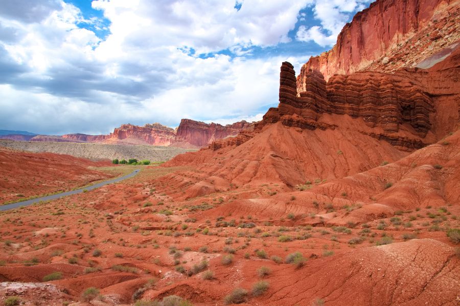
If you’re trying to make the most of one day in Capitol Reef National Park, you’re in the right spot! Often called Utah’s most underrated park, it’s full of character, rich history, and scenery that hits you the moment you roll in. And yes, you can absolutely see its highlights in a single day!
Set within the Waterpocket Fold, a nearly 100-mile warp in the Earth’s crust, the park delivers a wild mix of cliffs, canyons, domes, and natural “waterpockets” that collect rainwater in this otherwise arid landscape. Tectonic forces lifted and tilted these rock layers tens of millions of years ago, and erosion did the rest, carving out the dramatic landscape you see today.
The park’s human history is just as compelling. Indigenous peoples left their mark on the canyon walls, and later, Mormon pioneers established a small farming community here, planting orchards and building homesteads, traces of which still shape the landscape.
If you’re planning a quick visit, this guide breaks down exactly where to go, what to see, and how to enjoy the best of Capitol Reef in one day — delicious pie included!
Quick navigation:
- Quick tips before you go
- MORNING–MIDDAY:
- Visitor Center
- Fruita + Pie at the Gifford House
- Optional stop: Fruita Orchards
- A fun hike OR an easy stroll through more of Fruita
- Option A: Cohab Canyon Trail (A moderate hike)
- Option B: Fremont River Walk & Fruita path (A gentle walk)
- AFTERNOON:
- SUNSET:
- More tips for a smooth one-day visit
Before you go: Quick tips for Capitol Reef National Park
- The park is open 24/7, but the Visitor Center and other facilities follow seasonal hours.
- The road layout surprises a lot of first-timers.
- Highway 24 (Utah State Route 24) cuts through the park and is always FREE. It’s a public highway, not part of the fee area, although you’ll find several trailheads and points of interest around here.
- Turn off toward the Visitor Center/Fruita, and that road becomes the Scenic Drive. The first section all the way to Fruita is STILL FREE.
- FEES apply only on the Scenic Drive past the Fruita Campground (paid at the self-pay station (cash only) or at the Visitor Center). The pass is per vehicle, valid for 7 days, and national park passes are accepted.
- Where to stay: If you’re spending the night, book ahead. Fruita Campground is the most scenic and convenient option. There are other nearby campgrounds, or you can base yourself in Torrey, which offers hotels, inns, and vacation rentals.
- Services are limited. There are no restaurants inside the park, so stock up in Torrey before you head in.
- Cell service is spotty to nonexistent. Download offline maps or grab a paper map at the Visitor Center.
- Flash floods are a real hazard in canyons and on dirt roads in the park. Always check conditions, especially during summer monsoon season.
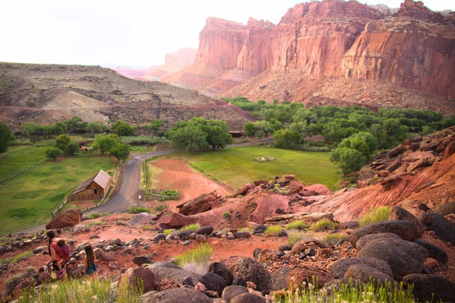
- Fruita is the park’s hub. This is where you’ll find the Visitor Center, the campground, and several key stops for a one-day visit.
- Best time to visit: late spring (April–June) and fall (September–October) for mild weather and fewer storms. Summer can be brutally hot with afternoon thunderstorms.

Morning: Visitor Center & Fruita Historic District

Stop 1: Visitor Center
Start your day at the Capitol Reef Visitor Center where you can grab a map, check current conditions with the park rangers, watch a short movie on Capitol Reef, and browse the gift shop. This is also the easiest place to pay for the Scenic Drive if you don’t have an annual park pass (if the Visitor Center is closed, no worries — there is a self-pay station on the Scenic Drive itself, but you’ll need cash).
- Time: 30 minutes.
Visitor Center hours:
Open daily except for major holidays. Hours change seasonally. For the most up-to-date info, call 435-425-3791.
Stop 2: Fruita Historic District + Pie at the Gifford House
From the Visitor Center, drive about a mile to Fruita, the surprisingly lush heart of Capitol Reef. In an otherwise dry desert, the green valley feels almost unreal, and yes, it’s the busiest part of the park.
Fruita was once a tiny Mormon pioneer settlement, established in the late 1800s. Families farmed the fertile riverbanks, planting fruit orchards that still thrive today. The town is now on the National Register of Historic Places and home to some of the park’s best picnic spots.
Several original structures remain, including the Gifford House, Fruita Barn (part of the Gifford Homestead), and Blacksmith Shop. The Blacksmith Shop sits just before the Gifford House, so stop there first or circle back afterward.


Gifford House 
Fruita Barn
The Gifford House, built in 1908 and home to three pioneer families throughout its early history, is now a museum and shop selling various handmade goods, jams and jellies, fresh bread, cinnamon rolls, and — most famously — pies made with fruit from the park’s historic orchards. Coffee and homemade ice cream are also available. Open seasonally from Pi Day (March 14) through October 31, the Gifford House is a must-stop for any visit.
Pro tip:
Arrive early! Pies often sell out by late morning, especially in summer.
Picnic options include a small area with picnic tables outside the shop and the larger Doc Inglesby Picnic Area between the Gifford House and Blacksmith Shop.
Parking: Small lot at the Gifford House (timed in peak season), overflow lot across from the Fruita Barn just down the road, large lot at Doc Inglesby Picnic Area, plus a small parking lot at the Blacksmith Shop (see the map for details and visuals).
Optional stop: Fruita Orchards

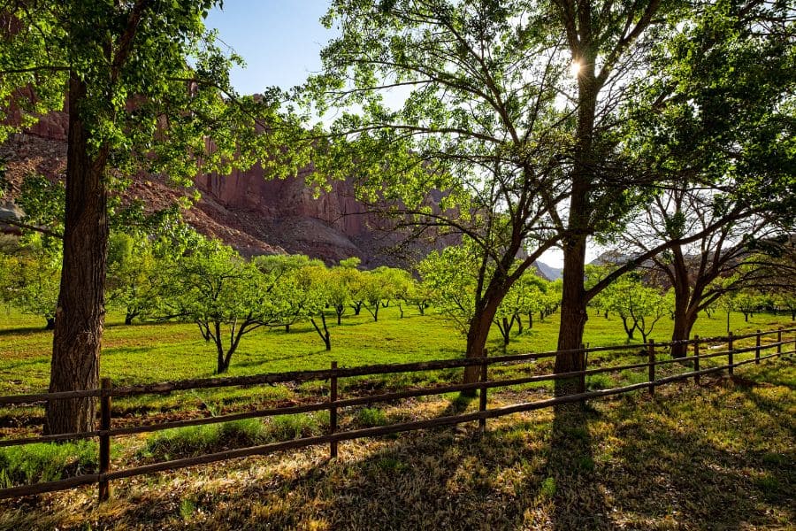
After sampling your pies (good luck with deciding on just one flavor haha), take a stroll through the historic orchards, many of which were planted by the pioneer families themselves. Scattered throughout the valley, they’re easy to explore on foot.

In spring, the orchards bloom; in late summer and fall they burst with apples, apricots, cherries, peaches, pears, and plums, depending on what’s in season. If you visit during harvest season, you can sample fruit from orchards marked for picking (yes, for FREE!) or take some home for a small fee (honor system is in effect, so please don’t abuse it).
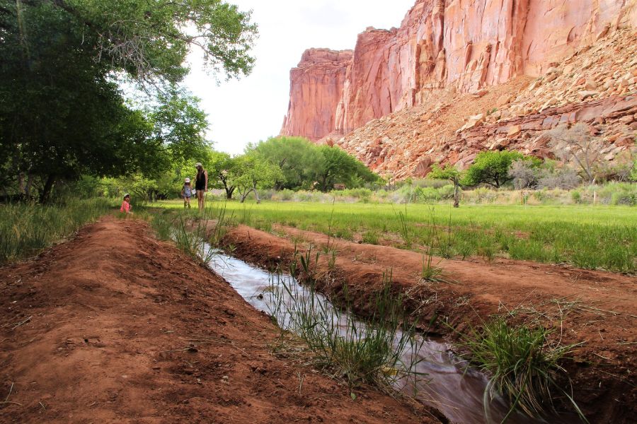
The irrigation ditches you’ll see throughout the orchards carry water from the Fremont River and Sulphur Creek, a system the pioneers designed and the park still maintains.
- Time: 2–3 hours total, including pie and visits to the Gifford House, Fruita Barn, Blacksmith Shop, and orchards.
Late morning/Midday: A fun hike OR an easy scenic stroll — right in Fruita
👉 If the heat is cranking up, you can easily bump this activity to later in the day. The afternoon activities include the Scenic Drive and Capitol Gorge Road which will bring you right back through Fruita afterward, so it’s easy to do the hike (or a relaxed wander in Fruita) once temperatures ease up.
Option A: Cohab Canyon Trail (moderate hike)

For a classic Capitol Reef hike, try the Cohab Canyon Trail — right from the Fruita area, no driving needed. The trailhead sits between the Fruita Barn and campground entrance. It’s moderately rated, quieter than the popular short trails, and winds through a colorful canyon with interesting rock formations.

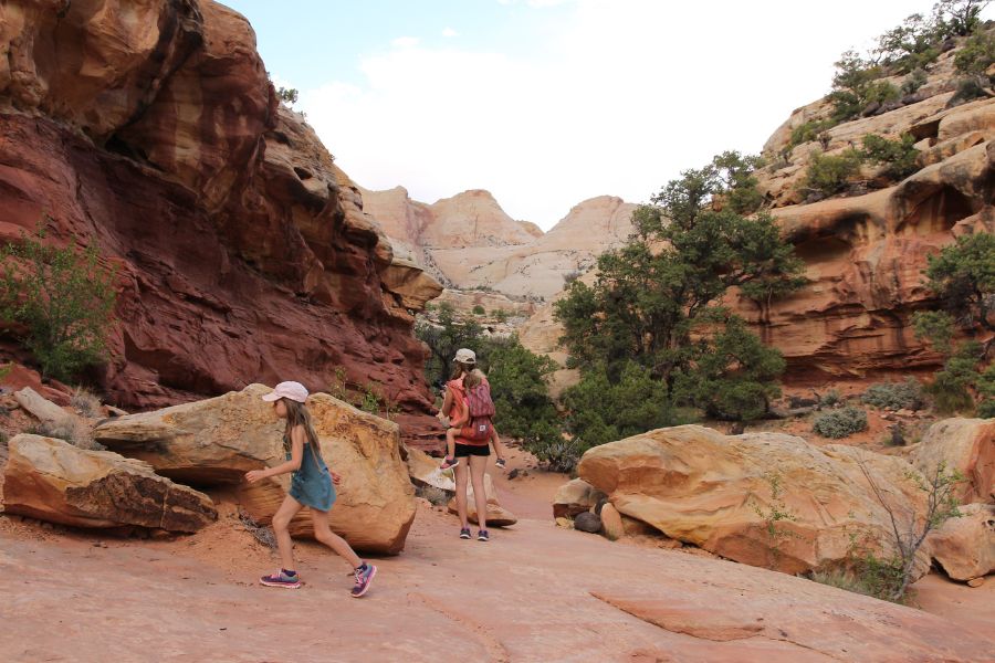
The Cohab Canyon Trail starts with a series of switchbacks gaining about 400 feet of elevation — modest but steady. Once you reach the top, the trail flattens and leads into a striking canyon that feels worlds apart from the trailhead. There’s an optional spur to scenic Fruita Valley viewpoints about halfway through. The trail continues across the canyon to its other entrance (this hike has two starting points), but the first ~half of the trail, including the overlooks, is the most picturesque. You can turn back anytime, making it easy to tailor the hike to your energy level.
- Time: 1–2.5 hours round trip if going up to ~halfway through (recommended).
Option B: Fremont River walk & Fruita path (gentle walk)

Prefer something low-effort? Explore more of Fruita on foot. The Fruita Path stretches past the campground and follows the Fremont River, offering scenic views of the valley and orchards. Fruita is walkable and packed with scenic spots to rest and enjoy the valley.


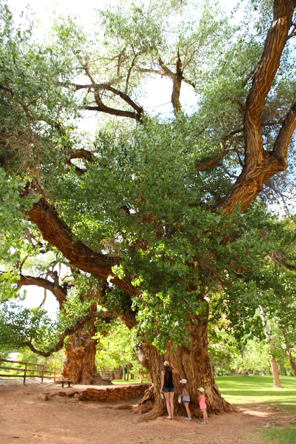
Nearby, the Ripple Rock Nature Center (across from the Blacksmith Shop) adds a fun educational stop. Mostly geared toward kids, the displays highlight local geology, and ranger talks sometimes dive deeper. Behind the center, you can also find remnants of old structures for a little extra history.
- Time: 1–1.5 hours, depending on how far you go.
Afternoon: Scenic Drive & Capitol Gorge Road + Pioneer Register
Capitol Reef Scenic Drive & Capitol Gorge Road

The Capitol Reef Scenic Drive winds through about 10 miles of the park’s most dramatic scenery — towering cliffs, colorful rock layers, and hidden canyons. Only the section beyond the Fruita Campground requires a fee; the first mile and a half is free. If you don’t have an annual pass, you can pay at the Visitor Center or at the self-pay station just past the campground (cash only).
The drive starts paved for 8 miles, then becomes Capitol Gorge Road, a graded dirt road that winds through narrow canyons for the final 2 miles to the Capitol Gorge Trailhead. This stretch is especially scenic, with towering canyon walls closing in as you drive — easily the most impressive section of the Scenic Drive! Most vehicles under 27 feet in length should be able to handle the dirt section in good weather, but check conditions first. Rain can make the road impassable, and flash flooding is a real threat.

- Driving time (round trip, without stops): ~1 hour.
Pioneer Register

A must-see historic highlight, the Pioneer Register features 19th-century settlers’ and prospectors’ names carved into the sandstone walls of Capitol Gorge.
In the late 1800s and early 1900s, this narrow canyon was the only passable route through the Waterpocket Fold, and travelers often marked their passage by carving their names or initials into the soft sandstone. Early carvings date back to the 1870s, including those of prospectors J.A. Call and Wal. Bateman.

The Pioneer Register is reached by a short, easy walk (about ½ mile from the Capitol Gorge Trailhead) along a sandy wash and is totally doable even for visitors who aren’t into hiking (just know the sand can be tiring, so comfortable shoes make a big difference).
Along the way, keep an eye out for faint Fremont-era petroglyphs, and start scanning the canyon walls soon after. Many signatures sit high above eye level and are easy to miss if you’re not actively looking for them. Why so high? Travelers likely climbed onto their wagons to carve their names as high as possible, and erosion did the rest. Back in the 1800s, the canyon floor sat much higher than it does today.

- Time: 30 minutes.
Optional: If you have extra time, you can continue further along the trail (the entire trail is a mile one way) or even take the short but challenging spur to the Tanks at the trail’s end (~0.4 miles round trip). These are natural sandstone basins (waterpockets) the Waterpocket Fold in Capitol Reef is named after. For a one-day visit, the initial canyon and Pioneer Register offer the best views (and the Tanks might be dried out), but here’s the full Capitol Gorge Trail description for consideration. On the way back, the Cassidy Arch/Grand Wash Trail is another easy add-on with dramatic canyon walls and straightforward route if you have some extra time.
Late afternoon: Petroglyphs, Fruita Schoolhouse & Behunin Cabin

Return to Fruita, and continue your day with a short visit to the Fremont Culture petroglyphs (the main petroglyph site in Capitol Reef National Park), about a mile east of the Visitor Center along Highway 24 (not the Scenic Drive). Two wooden boardwalks make the site easy to explore and photograph.

On the way, you’ll pass the historic Fruita Schoolhouse, built in 1896 and used until 1941. After visiting the petroglyphs, continue another five miles or so east to find the Behunin Cabin, one of the earliest homes in the Fruita District, built in 1883. Together, these stops offer another glimpse into the area’s pioneer history without requiring much time or effort.

Behunin Cabin 
Fruita Schoolhouse
- Time: ~1 hour, including short walks and photography.
Sunset: Panorama Point or Sunset Point

Wrap up your day with a stop at Panorama Point or Sunset Point, two scenic overlooks a short drive from the Visitor Center. They’re great at any time of day, but especially at sunset, offering some of Capitol Reef’s best views — a fantastic choice to end your one-day-visit of Capitol Reef National Park.
Panorama Point is the easiest and closest option, just off Highway 24 (2.5 miles west of the turnoff to Fruita/Visitor Center). A short walk leads to sweeping views of the cliffs and surrounding landscape — perfect opportunity to enjoy golden‑hour colors without much effort.
For a more immersive sunset experience, try Sunset Point. Continue one mile down Panorama Point Road (mostly dirt) to Goosenecks Overlook, then take the easy 0.4‑mile Sunset Point Trail for panoramic views of the Waterpocket Fold’s cliffs and canyon walls that glow beautifully as the sun sets.

Timing tip:
Arrive about an hour before sunset to fully enjoy the changing colors.
If you’re running out of time and want to catch sunset, there are several pullouts along Highway 24 with excellent views where you can linger as the light softens.
Tips for a smooth one-day visit
- Start early: Arrive at the Visitor Center when it opens to get a full day in.
- Pie first: The Gifford House pies sell out fast — grab one early!
- Hydration & sun protection: Trails are mostly exposed; bring sunscreen and plenty of water.
- Check the weather: Flash floods can happen suddenly along washes and canyons — always be prepared.
- Dogs: Limited pet-friendly options; check where dogs are allowed in Capitol Reef National Park before bringing your furry friend.


Hi, I’m Marketa!
Mom of two, Malinois wrangler, and the voice behind this blog. I share places worth the detour across the U.S., from remote backroads to favorite Chicago-area finds. Always chasing good views, great memories, and dog-friendly stops. More about us →


